Tuesday, August 30, 2011

0043 – Moita da Ladra walled enclosure

Location: Vila Franca de Xira municipality, Lisboa district, Estremadura, Central Portugal)
Chronology: Chalcolithic (with a previous occupation of Early Neolithic)
Bibliographic references: Cardoso, 2010.


The hill where the site is, with the Tagus River valley behind (after Cardoso, 2010)

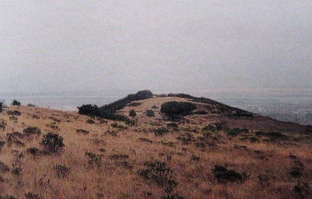
Located on a hilltop that dominates the lower Tagus river valley, this site presents a walled enclosure dated from plain/final Chalcolithic. The chronology is deduced by the presence of the locally characteristic decorated pottery (“Folha de Acácia” type), bell beaker vessels and copper and gold artefacts (Palmela point, gold decorated plate and object related to metallurgical work).

The stone wall is considered to represent a unique built phase, defining an ellipsoidal enclosure (44m x 80m), with an entrance in the South side (facing the Tagus River). It was built with local basalt rocks, but also with limestone, brought uphill from the bottom of the mount. Those limestone blocks were especially used in the wall faces (the middle was filled in basaltic rocks). The white of the limestone walls would have generated a strong visual contrast in the top of the dark volcanic hill.


Plan of the enclosure (after Cardoso, 2010)

That strategy of visibility is stressed by the author in the context of a territorial and circulation control between the Tagus valley and the hinterland of Lisbon Peninsula (as would represent the Zambujal walled enclosure in the other side of the Peninsula – the sea side). A settlement-fortress of a regional strategy of occupation, defence and control.

Nearby is the Verdelha dos Ruivos cave, used for Bell Beaker funerary depositions and related with the enclosure as its possible necropolis. The same hypothesis is developed for some local megalithic tombs (as Casal do Penedo ).

Thursday, August 25, 2011

0042 – Where have all the flowers gone?


Carrascal (Porto Torrão) ditch excavated by ERA Arqueologia (responsibility of Helena Santos)

I frequently remember the name of this song when I think about all of the geological material that was extracted in the processes of building ditches. Where have all the tons of geological material gone?

As I’ve said before, we completed this year a cross section in Ditch 6 of Perdigões, dated from Late Neolithic. This, combined with the plan obtain by geophysics, allows us to estimate the volume of bedrock extracted. Assuming similar shape and measures (sometimes they change along the ditches) of Ditch 6, that has almost a two hundred meters perimeter, the building process implied the excavation and removing of about 745 m3 of geological material (I will also calculate the weight).

I will deal later with the questions of logistics, labour and technical problems. For now I just renew the question: where is it?

Traditionally is assumed, I repeat assumed, that bank walls were built with that material, later eroded. The problem is that there are no evidences of that erosion in any of the already surveyed ditches at Perdigões (as in other Portuguese enclosures). They simply are filled with different materials (with exceptions for small erosion of ditch walls, as we can observe in a specific point of Ditch 6).

But the geological is also not outside the ditches, not even in Perdigões, that is topographically an amphitheatre, with the pendent orientated to the inside and East. Ditch 6 is in the centre of the natural amphitheatre. If there was a bank by the inside of the ditch built with the geological material there should be evidences of it. There are not.

If we think that at Perdigões are at least 11 ditches, progressively bigger than Ditch 6, we start to have an idea of the quantity of geological material removed there over time. Thousands of cubic meters; thousands of tons (it is now possible to also estimate the volumes for ditches 1, 3 and 4).

Where is it?

Monday, August 22, 2011

0041 – Late Neolithic ditch at Perdigões enclosure

In this year campaign we reach the base of Ditch 6 (the inner one) of the complex of ditched enclosures of Perdigões. It is 3 meters wide at the top, 2 meters deep and has a “u” section.
From bottom to top provide mainly faunal remains and pottery, addressed to Late Neolithic (second half of the 3rd millennium BC).


The processes of ditch filling of this section is different from the ones observed in Sector I, in Ditches 3 and 4, dated from plane Chalcolithic. As in Ditch 3 a significant change has been observe in the first half of the ditch, regarding the second (upper) half, separated by a moment of local erosion of the western wall of the ditch (not extendable to the entire surveyed area). In the lower part we have basically horizontal layers, with a moment of organized depositions of stones. After the wall erosion period, we have diagonal sedimentation pending from west (from the outside of the enclosure), including moments of formation of stone layers with the same pending.


The interpretation of this filling is still yet to be done (excavation just finished). But it is clear that the process had different phases (with different conditions) and doesn´t present clear structured depositions as can be observed in Ditches 3 and 4 (Mind that we are talking about small section of long ditches). Nevertheless, is a big ditch by Late Neolithic standards, only overcame in Portugal by one of the ditches excavated at Porto Torrão (Valera & Filipe, 2004).